GPS devices and know-how lead outdoor enthusiasts home
Stand-alone units facing competition from smartphone apps
When a lost mountain biker recently dialled 911 on his cellphone, Douglas Pope and his fellow search-and-rescue volunteers sprang into action.
The North Shore Rescue search manager told the Georgia Straight that his team called the uninjured man, who had slid into a gulley in the Mosquito Creek area, and found out he was carrying a handheld GPS device.
“He’d never really used it before,” Pope said by phone from North Vancouver. “But with us coaching him just to turn it on, let it warm up, and get his position, he was able to read his coordinates off the GPS and we were able to locate him very quickly.”
In his spare time, Pope hikes, mountain-bikes, skis, snowshoes, and trail-runs, and he advises everyone engaged in such outdoor pursuits to bring along a GPS device and know how to operate it.
A GPS device uses signals from satellites orbiting the Earth as part of the U.S.–developed Global Positioning System to determine its latitude, longitude, and altitude. In the 25 years since the first consumer handheld GPS receiver was released, these devices have shrunk in size, increased in accuracy, and gained better screen quality and numerous features.
At Mountain Equipment Co-op’s West Broadway store, customer service representative Matt Armstrong showed the Straight four GPS devices manufactured by Garmin. He noted all of them allow users to track their routes and save waypoints, so they can view the as-the-crow-flies distance, direction, and estimated time to a cabin, lake, or trailhead.

One of MEC’s best-selling devices, the entry-level eTrex 20 ($180), is about the size and weight of a cellphone and can also receive signals from GLONASS and WAAS satellites, boosting the speed and accuracy of location data. The eTrex 20 is waterproof, has a 2.2-inch colour screen, comes with a worldwide base map and a microSD card slot for additional maps, and works with Garmin’s BaseCamp trip-planning software for Mac and Windows.
Another popular model, the eTrex 30 ($250), adds a barometric altimeter and a three-axis compass to the eTrex 20’s features, computing ascent and descent rates and aiding navigation. When he’s backcountry-skiing, Armstrong uses the larger GPSmap 62st ($299), which comes loaded with Garmin’s Canadian topographic maps.
“It’s got a quad helix antenna,” Armstrong said. “So it means, in a variety of weather conditions and also terrain, I’m going to be able to maximize my opportunity to be able to get a signal.”

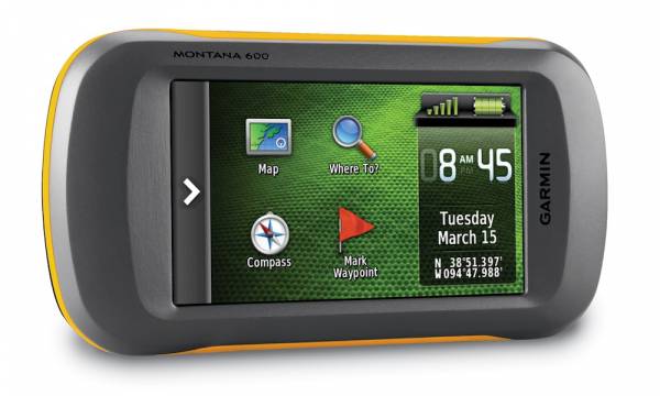
The more expensive Montana 600 ($530) boasts a four-inch touchscreen. According to Armstrong, this makes it easier to use and allows for better viewing of map details.
“The big thing is people want to know which button calls your friends to come get you, and the GPSes don’t have that,” Armstrong said. “That’s why it’s really important to be making smart decisions when you go into the backcountry.”
Andrew Drouin, founder and president of the South Okanagan Trail Alliance, recommends outdoor enthusiasts choose GPS devices that are waterproof, have a large colour screen, and come with a memory card loaded with high-quality maps. The avid snowshoer told the Straight newbies should enroll in a map, compass, and GPS navigation course. As well, they should remember to always bring extra batteries on a trip.
“Maybe I’m biased because I’m used to what I’m looking at on the screen, but to me, you’d have to be drunk to get lost in this day and age [because of GPS technology],” Drouin, who’s a director of the Federation of Mountain Clubs of B.C., said by phone from Penticton.
However, Drouin only carries a Garmin or Magellan GPS device as a backup in the backcountry, preferring to use mobile apps such as MotionX GPS ($0.99) for the iPhone. He said this app matches many stand-alone GPS receivers in terms of features, and users benefit from the iPhone’s top-quality touchscreen.
Drouin advises people using apps for navigation to buy a smartphone case offering an extra battery and impact protection, like those from Mophie.
“Pretty much, you can’t talk about GPS these days without talking about smartphones, just because every smartphone comes with built-in GPS capabilities and the software is so cheap,” Drouin said. “The best software in the world’s $5.”

North Shore Rescue’s Pope always takes a GPS device with him in the backcountry, whether he’s familiar with the terrain or not. When planning a trip to a new area, he’ll often search online for a GPS track and waypoints for the route and load them onto his device. (People share this data on Bivouac, ClubTread, LiveTrails, Trailpeak, and other websites.)
But Pope cautions against feeling a “false sense of security” and “blindly following a GPS”. He advises all backcountry users to carry a magnetic compass and paper map, take note of their surroundings, and backtrack as soon as they get off-trail.
Pope saves his cellphone’s battery power for emergencies. If he’s heading into an area that lacks cellular coverage, he’ll also pack a satellite communicator featuring an SOS button he can push to send his location to emergency responders.
DeLorme and Spot manufacture satellite communicators that allow users with a subscription to send text messages and GPS data to friends, family, and emergency services from anywhere with a clear view of the sky, Pope noted.
“I think that’s where the technology is going,” Pope said. “That kind of satellite texting will probably be married with the navigation ability of a GPS into one unit, which will be very good for backcountry users.”


Comments